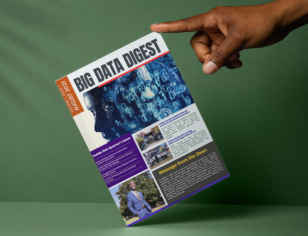
Geospatial Artificial Intelligence Enhanced Curriculum for Minority Serving Institutions (GAEC-MSI)

FAMU’s GAEC-MSI focuses on integrating AI and geospatial tools into the curriculum, preparing students for careers in environmental sciences and bioinformatics.


Announcement 📢


We are excited to invite you and your students to participate in the Nexus Innovate Geospatial AI Workshop, a transformative learning experience designed to inspire the next generation of STEM leaders. This workshop will be held on Saturday, January 25, 2025, from 10 a.m. to 3 p.m. at Florida A&M University and aims to provide high school students with hands-on experience and exposure to advanced geospatial science and artificial intelligence technologies.

↓ LEARN MORE ↓


At FAMU School of Environment, we care about using big data to ensure sustainable environmental outcomes. 

  • icon of a pair of binoculars

    ABOUT GAEC-MSI

    The GAEC-MSI will integrate new geospatial tools (AI, machine learning, and IoT) to address emerging areas in environmental engineering, bioinformatics, remote sensing, and geospatial science to grow and strengthen recruitment and graduate progression and training of geospatial professionals in an area of strategic emphasis in science, technology, engineering, and mathematics (STEM).

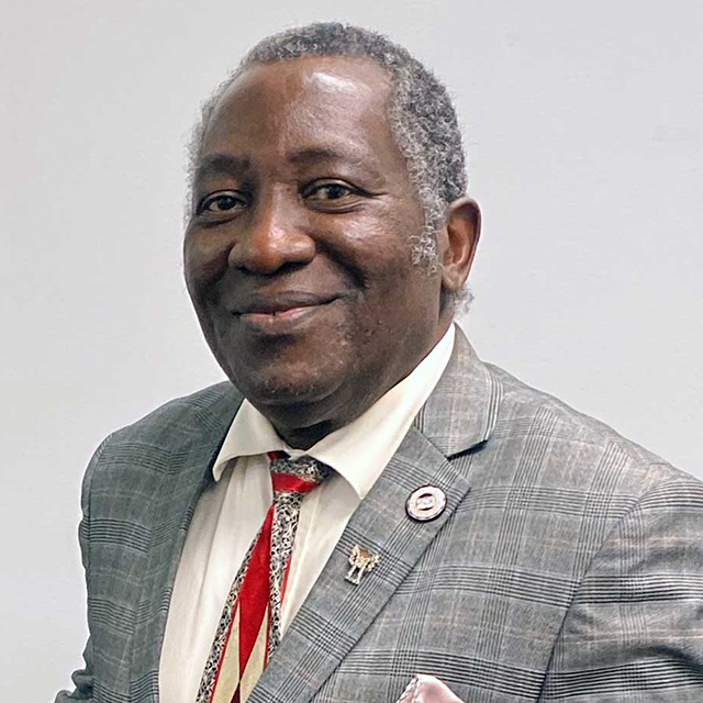
    The curriculum enhancement is transdisciplinary with a cadre of scientists and researchers led by Victor Ibeanusi, Ph.D. FAMU-Dean School of the Environment in partnership with Kentucky State University and Clark Atlanta University. 

  • icon of bullseye with an arrow

    OUR MISSION

    In an era of climate-induced environmental changes, finding innovative solutions to these challenges will depend on building a highly skilled and diverse workforce.  

    Geospatial AI is a digital brain trust focusing on the integration of new geospatial tools (AI, machine learning, and IoT)) to better address emerging areas in environmental engineering, bioinformatics, remote sensing, and geospatial science.

    Our goal is to increase and strengthen recruitment and training of geospatial professionals. 


Icon of a person stands on a podium, proudly holding a flag, symbolizing excellence

Icon depicting an orange figure at the forefront, representing leadership within a group of four individuals.

Curriculum Innovation

The intricate nature of environmental data presents considerable challenges for industry professionals. By equipping prospective and current environmental science students with training in cutting-edge software solutions and advanced AI methodologies, we can effectively convert real-world information into actionable insights.

This includes examples like using Machine Learning (ML) and Computer Vision technologies to handle complex datasets detect illegal landfills through UAV imagery and video analysis or using AI tools to evaluate and forecast water quality.

Workforce Development

In addition to transforming current environmental science curriculum with these emerging technologies, we believe exposing students earlier to this contributes to developing a more robust pipeline of qualified talent for careers in environmental sciences.

Building a progressive experience and exposure to data science will best prepare this new workforce for addressing global environmental issues and reducing the carbon footprint of agricultural and industrial activities. With technological advancement, AI, big data analytics, cloud-based computing, and data-driven decision-making, data science career development requires specific skills and training. A trained workforce that includes underrepresented groups is a force multiplier.

Faculty Training

Geospatial AI comprises diverse faculty from multi-institutions and interdisciplinary academic fields, each with robust experience and expertise in transdisciplinary research and training, including geospatial data management, remote sensing, AI, and IOT, etc. These faculty members will collaborate with committed partners to integrate innovative research and education into innovative, contemporary, inclusive training to develop next generation graduates and future workforce fully capable of addressing pressing national needs in the DOE domains

Placeholder image
victor.ibeanusi@famu.edu

Victor Ibeanusi, Ph.D.; Dh.c. (Honoris causa) is the Founder of the EnergyWaterFoodClimateNexus (EWFCN), a new science enterprise aimed at sustainable solutions for safe water, sustainable energy, food security, and climate resilience to expand the research frontier for new discoveries to the vexing challenges on our environment. [READ MORE...]

Placeholder image
buddy@email.com

Lorem ipsum dolor sit amet, consectetur adipiscing elit. Aenean euismod bibendum laoreet.Lorem ipsum dolor sit amet, consectetur adipiscing elit. Aenean euismod bibendum laoreet.

Placeholder image
olu@email.com

Lorem ipsum dolor sit amet, consectetur adipiscing elit. Aenean euismod bibendum laoreet.Lorem ipsum dolor sit amet, consectetur adipiscing elit. Aenean euismod bibendum laoreet.

Recruitment and Outreach

The deployment of innovative AI-focused environmental science curricula, site visit opportunities to national laboratories, access to student coemptions and other virtual events will introduce students to an exciting, sustainable, innovative industry: one in which they can use their skills and have a positive impact on DOE. Partnering with Dept of Energy enables us to encourage networking, community building, and strengthening both for teacher training and student education. 

Contacts: 

Victor Ibeanusi, Ph.D.; Dh.c. (Honoris causa)
Victor.Ibeanusi@famu.edu 

Joel Blount
Joel.Blount@famu.edu 

Current Issues

This proposal highlights the value of intelligent novel spatial applications, complex data, and science-based decision-making capabilities for long-term ecosystem monitoring and restoration. 

IoT devices can assist in data collection and monitoring in the field of bioinformatics. For instance, IoT sensors can capture data from soils, plants and wildlife habitats, to allow assessment of spatial and temporal patterns and changes. This data, when combined with geospatial tools, can aid in cleanup activities, ecological research, conservation efforts, and understanding the impact of environmental changes on biodiversity.

This curriculum will complement an existing concentration in the existing BS degree in Environmental Science offered in the School of the Environment. There are presently 5 Concentration areas for the BS in Environmental Science:  

➜ Sustainability Science;

➜ Environmental Toxicology-Risk Assessment;

➜ Environmental Monitoring and Instrumentation;

➜ Environmental Restoration and Waste management;

➜ and Environmental Policy.  

This new concentration area differs from these by focusing on the gathering and analysis of spatial data for a variety of environmental applications and related areas such as agriculture, natural resource management, and land use planning. Existing tracks do not include training in spatial analysis of large data sets, or acquisition of data by remote sensing, including drones, aircraft and satellite platforms.  The new concentration area will include specialized training in geospatial science, remote sensing theory and methodology relative to applications in environmental science.   


The curriculum in remote sensing will enable students to:

✔️ Explore utility of cloud-based geospatial environments (e.g., Google Earth Engine, Microsoft Azure- AI for Earth program) for cost-effective remote sensing and geospatial analysis.

✔️ Assist with development of landscape scale hydrologic assessments including processing of airborne LiDAR data and products for use in hydrologic models.

✔️ Development of novel, cost-effective techniques to monitor ecological and hydrologic change across relevant space and time scales within the Apalachicola region and Gulf coastal plain.

✔️ Explore utility of Drone Laser Scanning and Structure from Motion (SfM) techniques to develop point clouds and related ecosystem and hydrologic structure products using overlapping imagery from UAVs/drones, aircrafts and satellites.

✔️ Participate in the development of a regional geospatial decision support system (DSS) to assess and prioritize ecological and hydrologic restoration needs.

AI / ML can assist in analyzing complex environmental data sets, identifying patterns, and predicting outcomes. It can optimize the design and operation of sustainable infrastructure systems, such as water treatment plants, waste management systems, and renewable energy facilities. AI algorithms can also be utilized for environmental impact assessments and risk analysis, aiding in decision-making processes.


Events


Stay connected with all the exciting events happening. Don't miss out on opportunities to engage, learn, and network!


Join the The Nexus Innovate Geospatial AI Workshop January 25, 2025, from 10 a.m. to 3 p.m. High school students will compete to solve real-world environmental challenges using big data, geospatial tools, and innovative technology—with a chance to win a $5000 scholarship. Free admission!

Registration OPEN for Nexus Innovate Geospatial AI Workshop: Saturday, January 25, 2025, from 10 a.m. to 3 p.m. @ Florida A&M University @ Florida A&M University in Tallahassee Florida.

 
The Nexus Innovate Geospatial AI Workshop highlights the value of intelligent novel spatial applications, complex data analysis, and science-based decision-making capabilities for long-term ecosystem monitoring and restoration. This approach will strengthen key areas of STEM, including:
 
1. Artificial Intelligence (AI) and Machine Learning (ML):
  • Utilize AI and ML to analyze complex environmental data, identify patterns, and predict outcomes.
  • Optimize sustainable infrastructure systems like water treatment plants and renewable energy facilities.
  • Conduct environmental impact assessments and risk analyses to aid in decision-making.
2. Remote Sensing:
  • Explore cloud-based geospatial environments (e.g., Google Earth Engine, Microsoft Azure AI for Earth) for cost-effective remote sensing and analysis.
  • Develop landscape-scale hydrologic assessments using airborne LiDAR data.
  • Monitor ecological and hydrologic changes across the Apalachicola region and Gulf coastal plain using novel techniques.
  • Utilize Drone Laser Scanning and Structure from Motion (SfM) techniques for ecosystem and hydrologic structure products.
3. Bioinformatics:
  • Employ IoT devices for data collection and monitoring in soils, plants, and wildlife habitats.
  • Combine data with geospatial tools for ecological research, conservation efforts, and understanding biodiversity impacts.
4. Geospatial Science Remote Sensing:
  • Acquire and analyze data using drones, aircraft, and satellite platforms.
  • Specialize in geospatial science and remote sensing theory and methodology.

A flyer for the Nexus Innovate Geospatial AI Workshop:


To show our appreciation for your commitment to Geospatial-AI education, we are pleased to offer the following incentives:


Incentives for Participation

  • Why Should You Attend?

    Network Icon: Icon of an orange silhouette of a person connected to smaller silhouettes by green lines, symbolizing networking or social connections, on a green circular background.
    The Nexus Innovate Geospatial AI Workshop offers a unique opportunity for students to:

    - Engage with cutting-edge technologies and methodologies.

    - Gain hands-on experience with real-world applications.

    - Enhance their understanding of environmental and geospatial sciences.

    - Network with professionals and peers who share a passion for STEM.

    - Contribute to the development of solutions for complex environmental challenges.
  • Workforce Development

    Think Icon: "Icon of an orange silhouette of a head with two green gears inside, representing thinking and problem-solving, on a green circular background
    The workshop addresses the pressing need for a technically skilled geospatial and AI applications workforce.

    By participating, students will gain valuable skills that are critical to addressing national challenges and advancing their academic and career prospects. This initiative also supports diversity in STEM by providing opportunities for underrepresented groups to excel in high-demand fields.


  •  Scholarship Opportunity

    Education Icon: Icon of an academic cap resting on a stack of orange books, symbolizing education and learning, on a green circular background.
    Students will have an opportunity to earn a scholarship of up to $5,000.

    To qualify, students will need to apply and enroll in one of the School of the Environment degree programs.

    Admission applications must be received on or before April 1, 2025.

    A flyer for the Nexus Scholars-In-Residence Scholarship at Florida A&M University's (FAMU) School of the Environment. The flyer features a smiling student in a lab coat and the tagline "Unleash Your Potential, Shape Your Future." It highlights scholarship benefits such as undergraduate research experience, capstone projects, professional conference presentations, and internships. The award offers up to $5,000 and is open to newly admitted School of the Environment freshmen or transfer students. The application deadline is Tuesday, April 1, 2025.

    See Full Flyer

    Apply for Admission


Registration

For questions or to learn more, please contact Joel Blount at joel.blount@famu.edu or (850) 561-2641.  
Placeholder image
Register & RSVP Now
Spaces are limited, so we encourage you to sign up early to secure your spot. To register your students for the Nexus Innovate Geospatial AI Workshop, please RSVP!

 
Special: We are assembling a special collective of STEM Teachers to participate and meet with our team. If you’d like to be considered for an invitation, please register, and select STEM Teacher Collective Request
Register Now
 
 
We look forward to welcoming you and your students to this exciting event and empowering the future leaders of Geospatial-AI, who are powering the next transformative environmental engine solution for the future. For questions or to learn more, please contact Joel Blount at joel.blount@famu.edu or (850) 561-2641.